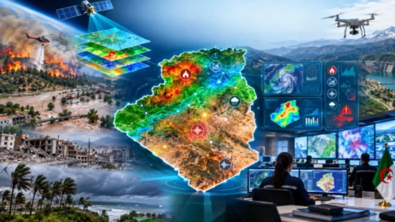
Experts anticipate artificial intelligence (AI), coupled with smart maps and 5G technology, will redefine disaster management in Algeria. Indeed, experts are betting on smart maps and 5G to redefine disaster management in Algeria using AI. These tools are seen as the primary defense against potential catastrophes, according to various specialists. Smart maps and AI are, in fact, considered the first line of defense against disasters. Algeria has faced significant challenges in recent years from forest fires and floods, which have noted the urgent need for improved predictive capabilities and preparedness measures. These events have prompted critical questions about predicting and preparing for risks before they occur. Authorities and experts identify forest fires, floods, and earthquakes as among the main dangers confronting the country. The integration of advanced mapping and AI is expected to enable more proactive strategies for mitigating these risks before they escalate.
Mapping Algeria's Risks
Algeria faces a reality that necessitates new local digital solutions for disaster management. Digital maps can carry multiple layers of information simultaneously, including land nature, vegetation cover, temperatures, water sources, road networks, and population centers. When this information is linked to AI systems, it becomes possible to analyze it, discover relationships, and convert it into digital indicators to understand the risk level in each area.
Floods represent another significant risk, particularly when heavy rainfall causes river levels to rise and water to accumulate in urban areas. This makes floods a major concern for the nation. Scientific studies in Algeria indicate the possibility of predicting fire risk to varying degrees, especially in identifying risk zones rather than precise timing and location. A recent study on the Jabal al-Wahsh mountain mass in Constantine province demonstrated the possibility of integrating climate data, satellite imagery, and Geographic Information Systems (GIS) with terrain, vegetation, and human activity factors to create fire susceptibility maps.
A study published in 2026 on the Eastern Aurès region showed the potential of using remote sensing and GIS to map forest fire susceptibility based on factors like slope, aspect, vegetation cover, and proximity to roads and settlements. Smart systems can combine data on terrain, riverbeds, slope, soil type, rainwater drainage networks, population centers, and rainfall data to identify areas prone to water accumulation or flooding. A recent Algerian study on M'Sila city showed the possibility of combining GIS and machine learning to map flood risks. Another study on the Sedrata basin in Ouargla province utilized machine learning and data-driven assessment to study flood susceptibility. Building an effective national risk management system requires an an integrated, constantly updated geographical, climatic, and environmental database.
AI's Predictive Power
Specialists believe expanding the 5G network is key for early warning systems in Algeria. For forest fires, artificial intelligence (AI) systems can link data points such as temperature, humidity, wind speed, vegetation type, terrain, and proximity to residential areas to identify zones requiring increased monitoring. These systems can specifically identify areas needing greater monitoring by correlating these diverse data points. AI's capacity to handle large amounts of data, compare them with historical records, and identify recurring patterns allows for the construction of strong risk prediction models. AI algorithms can analyze thousands or even millions of data points significantly faster than humans, revealing patterns that may not be apparent to the unaided eye. This speed and analytical depth are critical for timely risk assessments.
Previous research conducted in Algeria has shown the possibility of utilizing machine learning and neural network models to predict forest fires based on climate and environmental factors. Recent research also employs AI to analyze satellite images and map Algerian forests, which opens avenues for full monitoring, protection, and risk management efforts. This application of AI to satellite imagery is vital for understanding the vast and often remote forested areas.
Satellite imagery plays a key role by monitoring large areas that are difficult to cover continuously on the ground. These images can track vegetation changes, monitor the impacts of fires, compare pre- and post-disaster conditions, and utilize long time series to build extensive databases for AI learning. Building an accurate historical database of fire locations, intensity, and preceding environmental conditions can significantly improve future AI models for prediction.
Data points including temperature, wind speed, humidity, vegetation status, satellite imagery, and rainfall can be collected and analyzed to identify areas with high risk levels. AI can help pinpoint areas more susceptible to ignition, especially during periods characterized by hot, dry, and windy conditions. While AI cannot predict the exact time and location of a fire, it can effectively alert authorities that a specific area is high-risk, thereby necessitating increased monitoring and preparatory measures. This capability allows for a proactive stance against potential conflagrations.
Bridging Data to Action
Forest fires represent a significant risk requiring constant preparedness, particularly in Algeria's northern and eastern regions where extensive forests are located near populated areas. Developing prevention, prediction, monitoring, and early warning tools is considered essential, extending beyond technical aspects to form an integral part of a full system for population and property protection. Investing in digital data, maps, and artificial intelligence is seen as a way to enhance existing intervention capabilities rather than replacing them entirely. This investment serves to augment, not supersede, human efforts.
AI and smart maps can assist in identifying areas that may become isolated during flood events, determining roads that might be blocked, and pinpointing facilities requiring protection or evacuation measures. This includes identifying areas that may become isolated during floods, roads that might be blocked, and facilities needing protection or evacuation. Effective coordination between different sectors is necessary, as each sector, including meteorology, forestry, local authorities, and intervention agencies, holds key pieces of the disaster management puzzle.
The human element remains central to disaster management efforts; while algorithms can indicate high-risk areas, they do not provide on-the-ground details. AI should therefore be viewed as a decision-making tool, complementing human expertise rather than replacing it. The results from risk maps must reach operations rooms and benefit civil protection officers, forest officials, local authorities, and urban planners directly. This ensures that the insights generated by AI are translated into actionable strategies by those on the front lines.
Early detection of a fire in a remote forest area, facilitated by these technologies, allows intervention teams to respond more effectively by directing resources, warning nearby populations, and opening evacuation routes. This capability significantly improves response times and resource allocation. Smart maps can also identify areas near riverbeds, low-lying zones, and neighborhoods made more vulnerable to floods due to urban expansion. Combining smart maps with real-time rainfall and water level data enables more accurate and timely warnings for potential floods. This integrated approach provides a critical advantage in flood mitigation.
The Path Forward
UN experts state Algeria is obligated to employ Geographic Information Systems (GIS) to confront fires and floods effectively. Mirna Abu Atta, Regional Programs Officer at the UN Office for Disaster Risk Reduction (UNDRR) for the Arab States, noted that AI and smart maps can help Algeria transition from disaster response to anticipation. For this, Algeria requires a dynamic and updated national smart risk map, moving beyond static documentation. This dynamic map is key for effective, real-time decision-making. The country is not starting from scratch, with growing interest in GIS, remote sensing, and data analysis, alongside academic research focusing on AI for natural disaster studies. This existing foundation provides a strong starting point. A smart map helps officials identify sensitive forest areas, flood hotspots, and critical infrastructure like populations, roads, and facilities needing protection. However, AI's effectiveness relies on reliable data; outdated maps or limited climate information will restrict the system's learning and prediction capabilities. This notes the critical need for continuous data collection and updating. Algeria's next challenge involves transitioning from experimental studies and models to practical, daily-use systems. This transition is essential to fully realize the potential of these advanced technologies in national disaster management.